Description
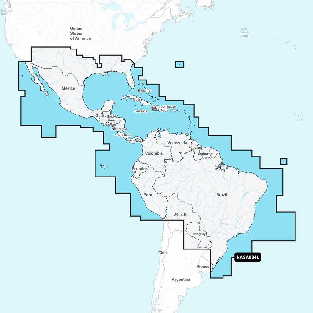
Get the #1 choice mondial in marine mapping – with the latest and greatest Navionics+ mapping on your compatible chartplotter. For coastal or inland waters, this all-in-one solution provides integrated, detail-rich mapping of coastal waters, lakes, rivers and more. Get SonarChart ™ 1 ‘(0.5 meter) HD bathymetric charts, advanced features such as dock-to-dock route guidance technology, live charting and plotter synchronization to provide wireless access to daily updates.The Navionics Chart Installer software also ensures the most up-to-date map data every time. Dock-to-dock route guidance solutions from Navionics suggest a path to follow through canals, creeks, marina entrances and more. Several shading options make navigating shallow waters easier and help highlight a target depth range for the best fishing spots.Coverage from Mexique, Central America and Brésil. Coverage includes the U.S. Gulf Coast and the U.S. East Coast to Savannah, GA; Bermuda; the Bahamas; Cuba; Hispaniola; Por…


Reviews
There are no reviews yet.